


la plagne : balade

manumax
User
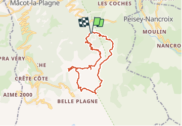

Length
16.1 km

Max alt
2401 m

Uphill gradient
969 m
Km-Effort
29 km

Min alt
1827 m

Downhill gradient
969 m
Boucle
Yes
Creation date :
2020-08-04 07:34:13.244
Updated on :
2020-08-04 12:41:39.459
5h06
Difficulty : Very easy

FREE GPS app for hiking
 SityTrail
IGN / Geographical institutes
SityTrail Plus
The world is yours!
About
Trail Walking of 16.1 km to be discovered at Auvergne-Rhône-Alpes, Savoy, La Plagne-Tarentaise. This trail is proposed by manumax.
Positioning
Country:
France
Region :
Auvergne-Rhône-Alpes
Department/Province :
Savoy
Municipality :
La Plagne-Tarentaise
Location:
Mâcot-la-Plagne
Start:(Dec)
Start:(UTM)
321730 ; 5045411 (32T) N.
Comments